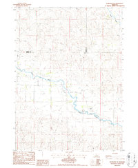
1986 Map of Koshopah SW
USGS Topo · Published 1986About this map
The North Loup River meanders across this mid-1980s landscape at the boundary of Blaine, Cherry, and Brown counties. This Nebraska Sandhills terrain is defined by its water sources, with numerous wells scattered throughout the sections to support the regional ranching economy. The Mellott Ranch stands as a primary named landmark in a region where the land is primarily partitioned for grazing. Toward the north, Goose Creek cuts through the topographic contours, while the area near Purdum illustrates the characteristic undulating surface of this part of the state. The map records a sparsely populated but active agricultural corridor, showing how natural drainage and groundwater management shaped the distribution of ranching operations.
Find a feature on this map
8 named features on this map. Tap any name to fly to it.
Don’t see what you’re looking for? This feature index may not catch every label — zoom into the map to look around manually.
Map Details
Editions of this 1986 Koshopah SW Map
This is the sole edition of this map. No revisions or reprints were ever made.
Other maps of this area

1948 · Halsey
USGS Topo · 1:62,500

1949 · Purdum
USGS Topo · 1:62,500

1949 · Koshopah
USGS Topo · 1:62,500

1950 · Halsey
USGS Topo · 1:62,500

1951 · Dunning
USGS Topo · 1:62,500

1951 · Purdum
USGS Topo · 1:62,500

1951 · Koshopah
USGS Topo · 1:62,500

1954 · North Platte
USGS Topo · 1:250,000

1956 · North Platte
USGS Topo · 1:250,000

1957 · North Platte
USGS Topo · 1:250,000