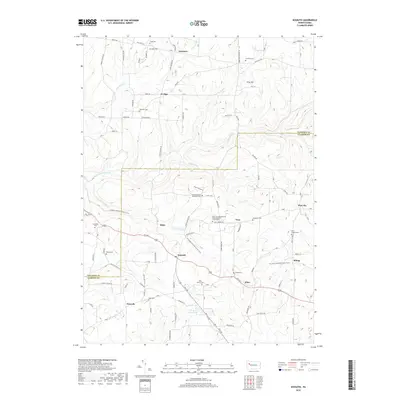
2019 Map of Kossuth
USGS Topo · Published 2019About this map
Kossuth and Nineveh anchor this rural landscape in the highlands of the Venango-Clarion county line. The region is defined by a dense network of local roads such as Old State RD and Fertigs RD that connect scattered agricultural settlements and family landmarks. This modern survey illustrates the persistent importance of early religious and educational sites, featuring the Fern Trinity Evangelical Congregational Churchyard and the Pinegrove School. Local history is deeply etched into the terrain through numerous small burial grounds, including the Schreffler Cem, Valley Cem, and Phipps Cem. The physical geography is marked by the winding courses of East Sandy Creek and Little E Sandy Cr, which carve through the high ground of Pine Hill and Cream Hill near the northern boundary.
Find a feature on this map
107 named features on this map. Tap any name to fly to it.
Don’t see what you’re looking for? This feature index may not catch every label — zoom into the map to look around manually.
Map Details
Editions of this 2019 Kossuth Map
This is the sole edition of this map. No revisions or reprints were ever made.
Other maps of this area

1906 · Clarion
USGS Topo · 1:62,500

1907 · Clarion
USGS Topo · 1:62,500

1907 · Foxburg
USGS Topo · 1:62,500

1908 · Foxburg
USGS Topo · 1:62,500

1922 · Oil City
USGS Topo · 1:48,000

1922 · Tionesta
USGS Topo · 1:62,500

1924 · Oil City
USGS Topo · 1:62,500

1924 · Tionesta
USGS Topo · 1:62,500

1943 · Oil City
USGS Topo · 1:62,500

1946 · Tionesta
USGS Topo · 1:62,500