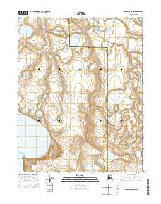
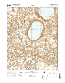
2014 Map of Kotzebue B-5 NW
USGS Topo · Published 2014About this map
Bering Land Bridge National Preserve encompasses most of this landscape on the Seward Peninsula, where the Nome Census Area meets the Northwest Arctic Borough. This 2014 survey reveals a subarctic wilderness characterized by intricate hydrography, featuring the massive Devil Mountain Lakes in the southwest and the winding course of the Kitluk River in the northwest. The terrain is marked by the W Fork Espenberg River drainage in the east, illustrating the complex wetland and permafrost patterns typical of the region. This map serves as a precise record of the landforms within this protected area, showing the elevation contours and township lines that define the remote boundary between these two major administrative regions in Alaska.
Find a feature on this map
11 named features on this map. Tap any name to fly to it.
Don’t see what you’re looking for? This feature index may not catch every label — zoom into the map to look around manually.
Map Details
Editions of this 2014 Kotzebue B-5 NW Map
This is the sole edition of this map. No revisions or reprints were ever made.
Other maps of this area

1950 · Kotzebue C-6
USGS Topo · 1:63,360
1950 · Kotzebue C-5
USGS Topo · 1:63,360

1950 · Kotzebue B-5
USGS Topo · 1:63,360

1950 · Kotzebue B-6
USGS Topo · 1:63,360

1951 · Kotzebue
USGS Topo · 1:250,000

1958 · Kotzebue
USGS Topo · 1:250,000

1964 · Kotzebue
USGS Topo · 1:250,000
2014 · Kotzebue B-5 SW
USGS Topo · 1:25,000
2014 · Kotzebue B-6 NE
USGS Topo · 1:25,000
2014 · Kotzebue B-5 SE
USGS Topo · 1:25,000