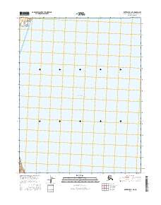
2016 Map of Kotzebue D-1 NE
USGS Topo · Published 2016About this map
Hotham Inlet dominates this coastal landscape in the Northwest Arctic region of Alaska. The area is defined by its low-lying, watery terrain where the inlet meets the northern reaches of the Baldwin Peninsula. This U.S. Geological Survey map illustrates the extensive network of wetlands and tidal flats that characterize this part of the Alaskan wilderness. The geography is systematically organized by the Public Land Survey System, with township boundaries such as t18n r16w and t19n r16w marking the expanse of the shoreline. For those studying the environmental history or indigenous land use of the Kotzebue Sound area, this document records the precise hydrological state of the inlet and its surrounding marshes during the mid-2010s.
Find a feature on this map
5 named features on this map. Tap any name to fly to it.
Don’t see what you’re looking for? This feature index may not catch every label — zoom into the map to look around manually.
Map Details
Editions of this 2016 Kotzebue D-1 NE Map
This is the sole edition of this map. No revisions or reprints were ever made.
Other maps of this area

1951 · Baird Mountains
USGS Topo · 1:250,000

1951 · Selawik
USGS Topo · 1:250,000

1951 · Noatak
USGS Topo · 1:250,000

1951 · Kotzebue
USGS Topo · 1:250,000

1951 · Kotzebue D-1
USGS Topo · 1:63,360

1951 · Selawik D-6
USGS Topo · 1:63,360

1952 · Selawik D-6
USGS Topo · 1:63,360

1955 · Noatak
USGS Topo · 1:250,000
1955 · Baird Mountains A-6
USGS Topo · 1:63,360
1955 · Noatak A-1
USGS Topo · 1:63,360