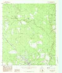
1984 Map of Kountze North
USGS Topo · Published 1985About this map
Kountze serves as the focal point of this Southeast Texas landscape, situated at the intersection of critical regional drainage systems. The northern reaches are dominated by the Big Thicket National Preserve Village Creek, where dense woodlands give way to the winding paths of Turkey Creek and Hickory Creek. The map documents a complex network of waterways, including the uniquely named Pea Monk Branch and Pinoak Branch, which feed into the broader basin. This area represents a critical intersection of preserved wilderness and local settlement, shown here before modern expansion. Traces of local history are evident in the small Cem locations and family-named landmarks like Mc Neely Lake and Bear Grass Ridge, which provide a geographic anchor for the region's rural character and natural topography.
Find a feature on this map
20 named features on this map. Tap any name to fly to it.
Don’t see what you’re looking for? This feature index may not catch every label — zoom into the map to look around manually.
Map Details
Editions of this 1984 Kountze North Map
This is the sole edition of this map. No revisions or reprints were ever made.
Other maps of this area

1954 · Beaumont
USGS Topo · 1:250,000

1955 · Silsbee
USGS Topo · 1:62,500

1955 · Kountze
USGS Topo · 1:62,500

1957 · Beaumont
USGS Topo · 1:250,000

1958 · Warren
USGS Topo · 1:62,500

1958 · Spurger
USGS Topo · 1:62,500

1984 · Beaumont
USGS Topo · 1:250,000
1984 · Silsbee
USGS Topo · 1:24,000
1984 · Kountze South
USGS Topo · 1:24,000
1984 · Warren
USGS Topo · 1:24,000