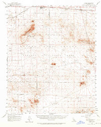
1956 Map of Kramer
USGS Topo · Published 1964About this map
Boron and the high desert interior take center stage in this mid-century topographic record of the western Mojave. The landscape is defined by the intersection of industrial development and military expansion, featuring the extensive Edwards Air Force Base boundary and the historical path of the Santa Fe RR. Settlement patterns are concentrated along the northern rail corridor, where the Rich (Site) and the busy crossroads at Kramer Junction indicate the era's reliance on both rail and highway transport.
Find a feature on this map
32 named features on this map. Tap any name to fly to it.
Don’t see what you’re looking for? This feature index may not catch every label — zoom into the map to look around manually.
Map Details
Editions of this 1956 Kramer Map
2 editions found
Other maps of this area

1915 · Searles Lake
USGS Topo · 1:250,000

1931 · Adobe
USGS Topo · 1:24,000

1931 · Hi Vista
USGS Topo · 1:24,000

1932 · Barstow
USGS Topo · 1:125,000

1934 · Barstow
USGS Topo · 1:125,000

1934 · Adobe
USGS Topo · 1:24,000

1935 · Hi Vista
USGS Topo · 1:24,000

1937 · Shadow Mountains
USGS Topo · 1:48,000

1937 · Kramer
USGS Topo · 1:48,000

1937 · Rogers Lake
USGS Topo · 1:48,000