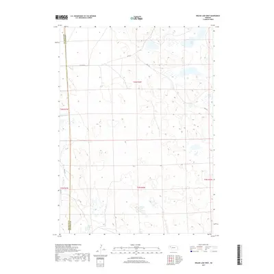
2017 Map of Krause Lake West
USGS Topo · Published 2017About this map
The high plains of Box Butte and Sheridan Counties are defined by a scattered network of ephemeral basins and small permanent water bodies. These features, including Twin Lakes, Peterson Lake, and the southern Fenner Lakes, characterize a landscape where water determines the geography of the Sandhills region. The map reveals a sparse infrastructure of local roads and trails, such as Jefferson Rd and 400th Trl, which follow the section lines of the Public Land Survey System. The township and range boundaries for t26n r46w and t25n r46w organize this agrarian terrain, showing how property and transit have been etched into the Nebraska panhandle. This survey provides a clear view of the natural hydrology and the rectilinear human footprint across this quiet stretch of prairie.
Find a feature on this map
15 named features on this map. Tap any name to fly to it.
Don’t see what you’re looking for? This feature index may not catch every label — zoom into the map to look around manually.
Map Details
Editions of this 2017 Krause Lake West Map
This is the sole edition of this map. No revisions or reprints were ever made.
Other maps of this area

1946 · Berea Creek East
USGS Topo · 1:24,000

1947 · Alliance
USGS Topo · 1:24,000

1947 · Box Butte
USGS Topo · 1:24,000

1948 · Berea Creek East
USGS Topo · 1:24,000

1948 · Alliance
USGS Topo · 1:24,000

1948 · Antioch
USGS Topo · 1:62,500

1949 · Antioch
USGS Topo · 1:62,500

1949 · Box Butte
USGS Topo · 1:24,000

1950 · Skunk Lake
USGS Topo · 1:62,500

1955 · Alliance
USGS Topo · 1:250,000