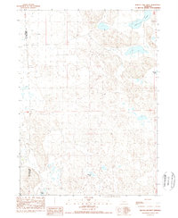
1989 Map of Krause Lake West
USGS Topo · Published 1989About this map
The boundary between Box Butte Co and Sheridan Co divides this late-twentieth-century landscape, characterized by the unique topography of the Nebraska Sandhills. This 1989 provisional survey documents the complex hydrology of the region, where water bodies like Twin Lakes and Krause Lake sit within a terrain of interdunal basins. The southern portion of the quadrangle is punctuated by the Fenner Lakes system, reflecting the shifting patterns of alkaline and freshwater lakes that define this part of the High Plains. Because this was produced from original manuscript drawings and aerial photography, it provides a precise record of the road network and section lines as they existed during the 1980s, offering a clear view of land use and ranching boundaries in a sparsely populated ranching territory.
Find a feature on this map
5 named features on this map. Tap any name to fly to it.
Don’t see what you’re looking for? This feature index may not catch every label — zoom into the map to look around manually.
Map Details
Editions of this 1989 Krause Lake West Map
This is the sole edition of this map. No revisions or reprints were ever made.
Other maps of this area

1946 · Berea Creek East
USGS Topo · 1:24,000

1947 · Alliance
USGS Topo · 1:24,000

1947 · Box Butte
USGS Topo · 1:24,000

1948 · Berea Creek East
USGS Topo · 1:24,000

1948 · Alliance
USGS Topo · 1:24,000

1948 · Antioch
USGS Topo · 1:62,500

1949 · Antioch
USGS Topo · 1:62,500

1949 · Box Butte
USGS Topo · 1:24,000

1950 · Skunk Lake
USGS Topo · 1:62,500

1955 · Alliance
USGS Topo · 1:250,000