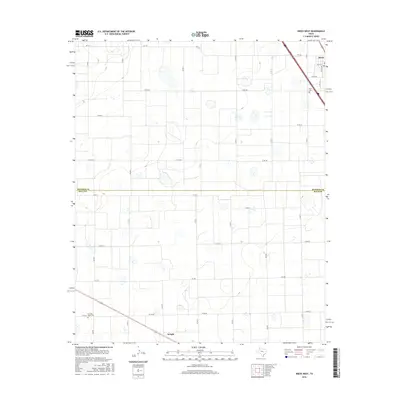
2016 Map of Kress West
USGS Topo · Published 2016About this map
Kress sits at the northern edge of this agricultural landscape in the Texas Panhandle, where the boundary between Swisher Co and Hale Co cuts across a grid of section roads. The map reveals a high-plains environment dominated by playa lakes and a sprawling network of farm-to-market and county routes, including Co Rd 5 and Co Rd 20. In the northeast, the outskirts of town are marked by Dudley Ave and Kress Cem. To the south, the settlement of Wright appears along the intersection of FM 788 and Co Rd P, while the Running Water Cem provides a specific point of interest for genealogists tracing family histories in the southern portion of the quadrangle. The regular spacing of roads like Co Rd BB and Co Rd DD reflects the systematic land division essential to the region's large-scale farming operations.
Find a feature on this map
32 named features on this map. Tap any name to fly to it.
Don’t see what you’re looking for? This feature index may not catch every label — zoom into the map to look around manually.
Map Details
Editions of this 2016 Kress West Map
This is the sole edition of this map. No revisions or reprints were ever made.
Other maps of this area

1954 · Plainview
USGS Topo · 1:250,000

1958 · Plainview
USGS Topo · 1:250,000

1965 · Edmonson NE
USGS Topo · 1:24,000

1965 · Kress West
USGS Topo · 1:24,000

1965 · Edmonson
USGS Topo · 1:24,000

1965 · Center Plains School
USGS Topo · 1:24,000

1965 · Wasson
USGS Topo · 1:24,000

1965 · Plainview
USGS Topo · 1:24,000

1968 · Halfway
USGS Topo · 1:24,000

1969 · Kress East
USGS Topo · 1:24,000