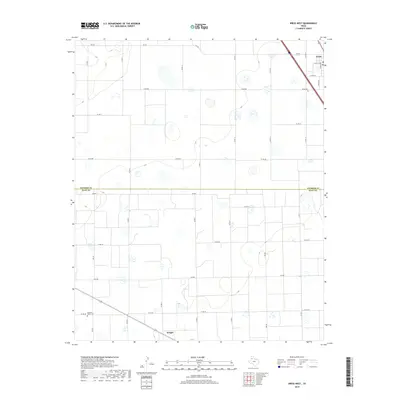
2019 Map of Kress West
USGS Topo · Published 2019About this map
The High Plains of the Texas Panhandle are documented here along the Swisher Co Hale Co line. The town of Kress occupies the northeast corner of the sheet, defined by its grid of streets including Dudley Ave and W 4th St. This agricultural landscape is meticulously partitioned by a network of farm-to-market roads and county routes, such as Fm 145 and Co Rd BB, which service the numerous irrigation and stock tanks scattered across the terrain. Genealogists will find the Kress Cem and the Running Water Cem in the southwest near the community of Wright. The map illustrates the specialized infrastructure of this semi-arid region, where the placement of every road and water source reflects a long-standing reliance on groundwater for ranching and farming.
Find a feature on this map
31 named features on this map. Tap any name to fly to it.
Don’t see what you’re looking for? This feature index may not catch every label — zoom into the map to look around manually.
Map Details
Editions of this 2019 Kress West Map
This is the sole edition of this map. No revisions or reprints were ever made.
Other maps of this area

1954 · Plainview
USGS Topo · 1:250,000

1958 · Plainview
USGS Topo · 1:250,000

1965 · Edmonson NE
USGS Topo · 1:24,000

1965 · Kress West
USGS Topo · 1:24,000

1965 · Edmonson
USGS Topo · 1:24,000

1965 · Center Plains School
USGS Topo · 1:24,000

1965 · Wasson
USGS Topo · 1:24,000

1965 · Plainview
USGS Topo · 1:24,000

1968 · Halfway
USGS Topo · 1:24,000

1969 · Kress East
USGS Topo · 1:24,000