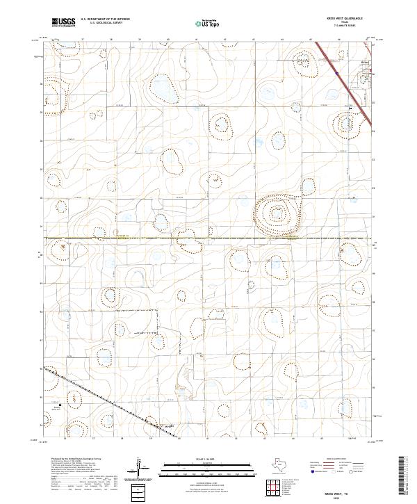
2022 Map of Kress West
USGS Topo · Published 2022About this map
The boundary between Swisher Co and Hale Co bisects this landscape of the Texas High Plains, where agricultural grids define the movement of local life. The small settlement of Kress occupies the northeast corner, positioned along a transportation corridor that includes FM 145 and several local streets such as Skipworth Ave and Dudley Ave. To the south, the community of Wright sits at the junction of FM 788 and Co Rd P, serving as a secondary node in this rural network. Genealogy researchers will find interest in the Kress Cem near the northern county line and the Running Water Cem located in the southwestern reaches of the sheet. The terrain is characterized by numerous small, scattered depressions and a dense network of section-line roads like Sun Rd and Nix Rd that facilitate access to the surrounding farmsteads.
Find a feature on this map
32 named features on this map. Tap any name to fly to it.
Don’t see what you’re looking for? This feature index may not catch every label — zoom into the map to look around manually.
Map Details
Editions of this 2022 Kress West Map
This is the sole edition of this map. No revisions or reprints were ever made.
Other maps of this area

1954 · Plainview
USGS Topo · 1:250,000

1958 · Plainview
USGS Topo · 1:250,000

1965 · Edmonson NE
USGS Topo · 1:24,000

1965 · Kress West
USGS Topo · 1:24,000

1965 · Edmonson
USGS Topo · 1:24,000

1965 · Center Plains School
USGS Topo · 1:24,000

1965 · Wasson
USGS Topo · 1:24,000

1965 · Plainview
USGS Topo · 1:24,000

1968 · Halfway
USGS Topo · 1:24,000

1969 · Kress East
USGS Topo · 1:24,000