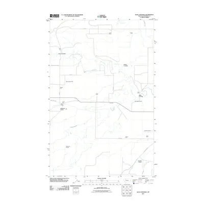
2011 Map of Kuka Crossing
USGS Topo · Published 2011About this map
Kingsbury Colony and Pondera Colony anchor this agricultural landscape in Pondera County, where a network of irrigation ditches and creeks supports ranching operations. The topography is defined by the broad Birch Creek Flats and several distinct geographical depressions known as coulees, including the memorably named Sober Up Coulee, Miller Coulee, and Cartwright Coulee. The movement of water is central to the area's development, evidenced by the Thomas Williamson Ditch, Ryan Lauffer Ditch, and Twenty-two K Canal. Rural life is dispersed across named family holdings such as the Pierce Ranch, Lauffer Ranch, and Moser Ranch. The map highlights several vital transit points over the waterways, most notably Kuka Crossing, Aubrey Crossing, and Pierce Crossing, which connect the isolated homesteads and provide access to the Dupuyer Cutoff.
Find a feature on this map
33 named features on this map. Tap any name to fly to it.
Don’t see what you’re looking for? This feature index may not catch every label — zoom into the map to look around manually.
Map Details
Editions of this 2011 Kuka Crossing Map
This is the sole edition of this map. No revisions or reprints were ever made.
Other maps of this area

1914 · Heart Butte
USGS Topo · 1:125,000

1918 · Heart Butte
USGS Topo · 1:125,000

1920 · Dupuyer
USGS Topo · 1:125,000

1934 · Lake Frances
USGS Topo · 1:48,000

1936 · Pendroy
USGS Topo · 1:48,000

1937 · Lake Frances
USGS Topo · 1:62,500

1941 · Pendroy
USGS Topo · 1:62,500

1960 · Cut Bank
USGS Topo · 1:250,000

1963 · Cut Bank
USGS Topo · 1:250,000

1964 · Cut Bank
USGS Topo · 1:250,000
Featured Places
- Aubrey Crossing, MT
- Pondera Colony, MT
- Kingsbury Hutterite Colony, MT
- Kuka Crossing, MT
- Pierce Crossing, MT