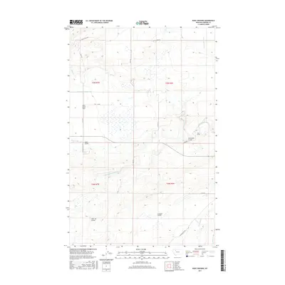
2017 Map of Kuka Crossing
USGS Topo · Published 2017About this map
Birch Creek winds through the northern portion of this Pondera County landscape, defining a region where water management and ranching roads dominate the geography. The terrain is characterized by a series of distinct drainages such as Sober Up Coulee and Miller Coulee, leading toward the expansive Birch Creek Flats. The intricate network of irrigation features, including the Thomas Williamson Ditch, Ryan Lauffler Ditch, and the Twentywo K Canal, illustrates the essential infrastructure required to support agriculture in this part of Montana. Named landmarks like Kuka Crossing and a lone Chapel near Stoltz Rd serve as focal points for the local community, while a grid of rural routes including Molly's Nipple Rd and Valier-Dupuyer Rd connect the scattered homesteads and Coulees of the high plains.
Find a feature on this map
28 named features on this map. Tap any name to fly to it.
Don’t see what you’re looking for? This feature index may not catch every label — zoom into the map to look around manually.
Map Details
Editions of this 2017 Kuka Crossing Map
This is the sole edition of this map. No revisions or reprints were ever made.
Other maps of this area

1914 · Heart Butte
USGS Topo · 1:125,000

1918 · Heart Butte
USGS Topo · 1:125,000

1920 · Dupuyer
USGS Topo · 1:125,000

1934 · Lake Frances
USGS Topo · 1:48,000

1936 · Pendroy
USGS Topo · 1:48,000

1937 · Lake Frances
USGS Topo · 1:62,500

1941 · Pendroy
USGS Topo · 1:62,500

1960 · Cut Bank
USGS Topo · 1:250,000

1963 · Cut Bank
USGS Topo · 1:250,000

1964 · Cut Bank
USGS Topo · 1:250,000
Featured Places
- Aubrey Crossing, MT
- Pondera Colony, MT
- Kingsbury Hutterite Colony, MT
- Kuka Crossing, MT
- Pierce Crossing, MT