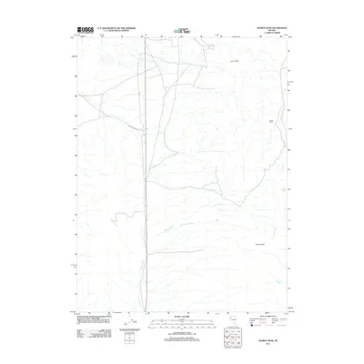
2011 Map of Kumiva Peak
USGS Topo · Published 2011About this map
Kumiva Peak and Luxor Peak define the high desert topography of this Washoe County region, where water sources like Mountain Spring and Rock Spring were essential for the survival of early ranching operations. The map documents the persistent human presence in this arid landscape, centered on Cowles Ranch and the long transit corridor of Empire Ranch Rd. Drainage patterns are clearly marked by Jenny Creek, Little Jenny Creek, and the isolated Rosebud Spring to the south. This 2011 survey, produced by the U.S. Geological Survey, reflects the modern geographic layout of a territory defined by high peaks and seasonal watercourses, providing a reliable reference for the relationship between the few named ranch sites and the natural spring network.
Find a feature on this map
9 named features on this map. Tap any name to fly to it.
Don’t see what you’re looking for? This feature index may not catch every label — zoom into the map to look around manually.
Map Details
Editions of this 2011 Kumiva Peak Map
This is the sole edition of this map. No revisions or reprints were ever made.
Other maps of this area

1886 · Granite Range
USGS Topo · 1:250,000

1894 · Granite Range
USGS Topo · 1:250,000

1955 · Lovelock
USGS Topo · 1:250,000

1959 · Lovelock
USGS Topo · 1:250,000

1964 · Gerlach
USGS Topo · 1:62,500

1964 · Kumiva Peak
USGS Topo · 1:62,500

1980 · Tenmile
USGS Topo · 1:24,000

1981 · Gerlach
USGS Topo · 1:100,000
1981 · Betty Creek
USGS Topo · 1:24,000
1981 · Jayhawk Well
USGS Topo · 1:24,000