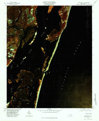
1980 Map of Kure Beach
USGS Topo · Published 1985About this map
Smith Island and the complex tidal estuaries at the mouth of the Cape Fear River are revealed in stark detail through this 1980 color infrared orthophotograph. The imagery captures the winding hydrology of Muddy Slough and the marshy expanses surrounding Buzzard Bay, highlighting the delicate threshold between the mainland and the Atlantic Ocean. Inland from the coast, a network of drainages including Governors Creek, Walden Creek, and Nancys Creek weave through the low-lying landscape, while Cape Creek and Cedar Creek define the southern reaches near the island. This photographic record, produced by the Geological Survey and the State of North Carolina, emphasizes the natural landforms and water systems of the Cape Fear region before further modern coastal development took hold.
Find a feature on this map
10 named features on this map. Tap any name to fly to it.
Don’t see what you’re looking for? This feature index may not catch every label — zoom into the map to look around manually.
Map Details
Editions of this 1980 Kure Beach Map
This is the sole edition of this map. No revisions or reprints were ever made.
Other maps of this area

1942 · Wilmington
USGS Topo · 1:62,500

1942 · Cape Fear
USGS Topo · 1:24,000

1943 · Funston
USGS Topo · 1:24,000

1946 · Southport
USGS Topo · 1:24,000

1946 · Snow Marsh
USGS Topo · 1:24,000

1948 · Wilmington
USGS Topo · 1:62,500

1949 · Georgetown
USGS Topo · 1:250,000

1953 · Florence
USGS Topo · 1:250,000

1953 · Beaufort
USGS Topo · 1:250,000

1954 · Florence
USGS Topo · 1:250,000