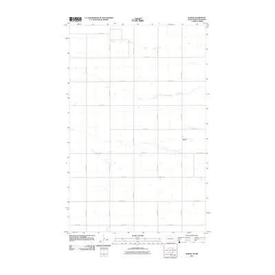
2011 Map of Kuroki
USGS Topo · Published 2011About this map
Kuroki sits near the Canadian border in Bottineau County, defining the small settlement character of the North Dakota plains. This 2011 survey by the U.S. Geological Survey details a landscape governed by a precise section-line road network, where routes like 109th St NW and 20th Ave NW carve the prairie into predictable rectangles. The terrain is marked by numerous small, scattered wetlands and depressions typical of the regional geography, interspersed between the gravel roads. While the area is largely rural, the presence of Kuroki at the intersection of local thoroughfares highlights a moment in time before further rural consolidation, offering a clear record of the local infrastructure and land divisions used for agricultural management in the early twenty-first century.
Find a feature on this map
15 named features on this map. Tap any name to fly to it.
Don’t see what you’re looking for? This feature index may not catch every label — zoom into the map to look around manually.
Map Details
Editions of this 2011 Kuroki Map
This is the sole edition of this map. No revisions or reprints were ever made.
Other maps of this area
1949 · Westhope SW
USGS Topo · 1:24,000
1950 · Westhope SW
USGS Topo · 1:24,000
1950 · Antler
USGS Topo · 1:24,000
1950 · Renville
USGS Topo · 1:24,000
1951 · Westhope SE
USGS Topo · 1:24,000
1951 · Kuroki
USGS Topo · 1:24,000
1951 · Westhope
USGS Topo · 1:24,000
1954 · Minot
USGS Topo · 1:250,000
1958 · Minot
USGS Topo · 1:250,000
2011 · Renville
USGS Topo · 1:24,000