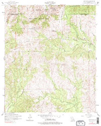
1954 Map of Kurthwood
USGS Topo · Published 1977About this map
Fort Polk Military Reservation dominates the western portion of this 1950s landscape, illustrating the significant military footprint in Vernon Parish during the mid-century era. The northern section is marked by the Peason Ridge Artillery Range, where the terrain is crisscrossed by several dismantled railroads, pointing to a previous era of intensive logging or military transport that had already begun to recede by the time of this survey.
Find a feature on this map
35 named features on this map. Tap any name to fly to it.
Don’t see what you’re looking for? This feature index may not catch every label — zoom into the map to look around manually.
Map Details
Editions of this 1954 Kurthwood Map
3 editions found
Other maps of this area

1941 · Leesville
USGS Topo · 1:62,500

1941 · Slagle
USGS Topo · 1:62,500

1942 · Florien
USGS Topo · 1:62,500

1942 · Kisatchie
USGS Topo · 1:62,500

1943 · Leesville
USGS Topo · 1:62,500

1943 · Kisatchie
USGS Topo · 1:62,500

1944 · Florien
USGS Topo · 1:62,500

1944 · Slagle
USGS Topo · 1:62,500

1946 · Leesville
USGS Topo · 1:62,500

1948 · Leesville
USGS Topo · 1:62,500