
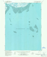
1951 Map of Kuskokwim Bay
USGS Topo · Published 1951About this map
Coastal settlements along the Bering Sea and Kuskokwim Bay define this 1951 survey of southwestern Alaska. The map traces the intricate water network where the Kuguklik River and Kanektok River meet the salt water, highlighting subsistence locations and isolated outposts such as Kwinhagak and Kipnuk. To the west, Cape Avinof projects into the Etolin Strait, marking a remote stretch of coastline dotted with small seasonal sites like Anogok and named landmarks including Rice and Loon.
Find a feature on this map
30 named features on this map. Tap any name to fly to it.
Don’t see what you’re looking for? This feature index may not catch every label — zoom into the map to look around manually.
Map Details
Editions of this 1951 Kuskokwim Bay Map
This is the sole edition of this map. No revisions or reprints were ever made.
Other maps of this area

1950 · Bethel
USGS Topo · 1:250,000

1950 · Hagemeister Island D-6
USGS Topo · 1:63,360

1951 · Cape Mendenhall
USGS Topo · 1:250,000

1951 · Nunivak Island
USGS Topo · 1:250,000

1951 · Goodnews
USGS Topo · 1:250,000

1951 · Hagemeister Island
USGS Topo · 1:250,000

1951 · Baird Inlet
USGS Topo · 1:250,000

1952 · Cape Mendenhall
USGS Topo · 1:250,000
1953 · Kuskokwim Bay D-2
USGS Topo · 1:63,360

1954 · Nunivak Island
USGS Topo · 1:250,000