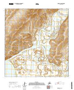
2020 Map of Kwiguk A-3 SE
USGS Topo · Published 2020About this map
Saint Marys and Pitkas Point anchor this river-dominated landscape at the confluence of the Andreafsky River and the mighty Yukon River. The topography transitions from the low-lying wetlands and intricate waterways of Steamboat Slough and Margaret Slough to the rising terrain of the Andreafsky Hills in the north. This survey illustrates the vital connection between these riverbank communities and the interior via local infrastructure like Airport Road, Airguard Rd, and Yupik Road. The complex hydrography, including the East Fork Andreafsky River, reveals the shifting nature of the delta region's channels and floodplains, providing a detailed view of the environment that sustains these remote Alaskan settlements.
Find a feature on this map
17 named features on this map. Tap any name to fly to it.
Don’t see what you’re looking for? This feature index may not catch every label — zoom into the map to look around manually.
Map Details
Editions of this 2020 Kwiguk A-3 SE Map
This is the sole edition of this map. No revisions or reprints were ever made.
Other maps of this area

1951 · Marshall
USGS Topo · 1:250,000

1952 · Kwiguk
USGS Topo · 1:250,000

1952 · Kwiguk A-2
USGS Topo · 1:63,360

1952 · Kwiguk A-3
USGS Topo · 1:63,360

1952 · Marshall D-4
USGS Topo · 1:63,360

1952 · Marshall D-3
USGS Topo · 1:63,360

1954 · Marshall
USGS Topo · 1:250,000
2018 · Kwiguk A-2 NW
USGS Topo · 1:25,000
2018 · Kwiguk A-2 SW
USGS Topo · 1:25,000
2020 · Marshall D-4 NE
USGS Topo · 1:25,000