
1952 Map of Kwiguk A-2
USGS Topo · Published 1959About this map
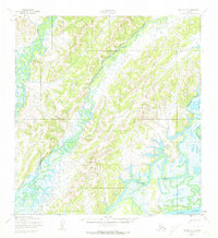
Pilot Village sits along the northern banks of the winding Yukon River in this 1952 study of the Alaskan interior. The landscape is defined by the complex aquatic network of the Chuilnak River and the Andreafsky River, which meander through a series of low-lying hills and marshy lowlands. The survey highlights the East Fork of the Andreafsky, illustrating the intricate drainage patterns that dictated travel and survival in this subarctic environment. A lone Winter Trail provides the primary overland connection, snaking across the terrain toward the village. This document, produced by the U.S. Geological Survey and the Corps of Engineers, provides a detailed look at the hydrology and rudimentary infrastructure of the Kusilvak region before modern developments.
Find a feature on this map
6 named features on this map. Tap any name to fly to it.
Don’t see what you’re looking for? This feature index may not catch every label — zoom into the map to look around manually.
Map Details
Editions of this 1952 Kwiguk A-2 Map
2 editions found
Other maps of this area

1951 · Marshall
USGS Topo · 1:250,000

1952 · Kwiguk
USGS Topo · 1:250,000

1952 · Kwiguk B-3
USGS Topo · 1:63,360

1952 · Kwiguk B-2
USGS Topo · 1:63,360

1952 · Kwiguk A-1
USGS Topo · 1:63,360

1952 · Kwiguk B-1
USGS Topo · 1:63,360

1952 · Kwiguk A-3
USGS Topo · 1:63,360
1952 · Marshall D-2
USGS Topo · 1:63,360

1952 · Marshall D-3
USGS Topo · 1:63,360

1954 · Marshall
USGS Topo · 1:250,000