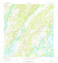
1952 Map of Kwiguk A-2
USGS Topo · Published 1973About this map
Pilot Village sits along the northern banks of the Yukon River at a point where the massive waterway meets an intricate network of tributaries and overland routes. Based on 1951 aerial photography, this survey documents the complex delta-like hydrology of the region, defined by the winding course of the Chuilnak River and the Andreafsky River as they thread through the terrain. A notable feature for researchers of early 20th-century Alaskan transit is the Winter Trail (Approximate), which provides a terrestrial connection across the landscape during the frozen months. The map also delineates the East Fork and various unnamed drainages, illustrating the seasonal nature of transportation and settlement in the Kusilvak region before modern infrastructure.
Find a feature on this map
6 named features on this map. Tap any name to fly to it.
Don’t see what you’re looking for? This feature index may not catch every label — zoom into the map to look around manually.
Map Details
Editions of this 1952 Kwiguk A-2 Map
2 editions found
Other maps of this area

1951 · Marshall
USGS Topo · 1:250,000

1952 · Kwiguk
USGS Topo · 1:250,000

1952 · Kwiguk B-3
USGS Topo · 1:63,360

1952 · Kwiguk B-2
USGS Topo · 1:63,360

1952 · Kwiguk A-2
USGS Topo · 1:63,360

1952 · Kwiguk A-1
USGS Topo · 1:63,360

1952 · Kwiguk B-1
USGS Topo · 1:63,360

1952 · Kwiguk A-3
USGS Topo · 1:63,360
1952 · Marshall D-2
USGS Topo · 1:63,360

1952 · Marshall D-3
USGS Topo · 1:63,360