
1952 Map of Kwiguk B-3
USGS Topo · Published 1958About this map
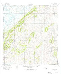
Atahualinguk River meanders through a landscape of high, complex terrain in this mid-century topographic study. The area is defined by sharp contour intervals and numerous unnamed summits, many reaching elevations between 500 and 900 feet. In the northwest, the land transitions into a low-lying marshy plain dotted with small, unnamed lakes and ponds, typical of the coastal Alaskan interior. This survey was mapped by the Army Map Service using aerial photography from 1951-1952, capturing the region as it existed before modern development or infrastructure. The complete absence of roads, buildings, or named settlements highlights the wilderness character of the Kusilvak region during the early fifties, with only the River and its tributary Creek serving as primary geographic markers.
Find a feature on this map
3 named features on this map. Tap any name to fly to it.
Don’t see what you’re looking for? This feature index may not catch every label — zoom into the map to look around manually.
Map Details
Editions of this 1952 Kwiguk B-3 Map
2 editions found
Other maps of this area

1952 · Kwiguk
USGS Topo · 1:250,000

1952 · Kwiguk B-2
USGS Topo · 1:63,360

1952 · Kwiguk C-2
USGS Topo · 1:63,360

1952 · Kwiguk C-3
USGS Topo · 1:63,360

1952 · Kwiguk A-2
USGS Topo · 1:63,360

1952 · Kwiguk C-4
USGS Topo · 1:63,360

1952 · Kwiguk A-4
USGS Topo · 1:63,360

1952 · Kwiguk A-3
USGS Topo · 1:63,360

1952 · Kwiguk B-4
USGS Topo · 1:63,360
2018 · Kwiguk B-2 SW
USGS Topo · 1:25,000