
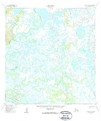
1952 Map of Kwiguk A-1
USGS Topo · Published 1959About this map
The Chuilnak River and Kuyukutuk River meander across this deltaic landscape, creating an intricate network of oxbow lakes, marshes, and waterways. This early 1950s survey captures the region's geography before significant modern changes, centered on the complex drainage patterns north of the Yukon River. The presence of Cabins and the Winter Trail in the southern portion of the map suggests seasonal navigation and subsistence patterns typical of the era. The vast wetland environment is defined by the Five Day Slough, illustrating the dynamic nature of water movement in this subarctic terrain. For researchers and historians, the map provides a clear record of established routes and temporary dwellings that supported travel and life along the river systems during this period.
Find a feature on this map
6 named features on this map. Tap any name to fly to it.
Don’t see what you’re looking for? This feature index may not catch every label — zoom into the map to look around manually.
Map Details
Editions of this 1952 Kwiguk A-1 Map
2 editions found
Other maps of this area

1947 · Russian Mission
USGS Topo · 1:250,000

1950 · Russian Mission
USGS Topo · 1:250,000

1951 · Marshall
USGS Topo · 1:250,000

1951 · Holy Cross
USGS Topo · 1:250,000

1952 · Kwiguk
USGS Topo · 1:250,000

1952 · Kwiguk B-2
USGS Topo · 1:63,360

1952 · Holy Cross B-6
USGS Topo · 1:63,360

1952 · Kwiguk A-2
USGS Topo · 1:63,360

1952 · Kwiguk B-1
USGS Topo · 1:63,360

1952 · Holy Cross A-6
USGS Topo · 1:63,360