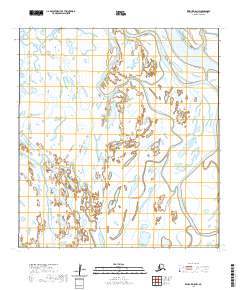
2020 Map of Kwiguk D-5 NW
USGS Topo · Published 2020About this map
Kwikpak Pass dominates the northeastern corner of this remote delta landscape, serving as a primary waterway within the complex hydrologic network of the Kusilvak region. The terrain is defined by a dense web of wetlands and minor watercourses, including the winding Kwikpakak Slough, which meanders through the central and eastern sections of the quadrangle. This 2020 survey illustrates the dynamic nature of the Yukon-Kuskokwim Delta, where shifting channels and vast marshlands dictate the geography of the area. The map is largely structured by the Public Land Survey System, showing township boundaries like t33n r80w and t34n r79w across an otherwise unpopulated wilderness. For researchers of Alaskan geography, it provides a precise modern record of the hydrography before further seasonal or climate-driven changes alter these sensitive alluvial paths.
Find a feature on this map
9 named features on this map. Tap any name to fly to it.
Don’t see what you’re looking for? This feature index may not catch every label — zoom into the map to look around manually.
Map Details
Editions of this 2020 Kwiguk D-5 NW Map
This is the sole edition of this map. No revisions or reprints were ever made.
Other maps of this area

1951 · St Michael
USGS Topo · 1:250,000

1952 · Kwiguk
USGS Topo · 1:250,000

1952 · Saint Michael A-5
USGS Topo · 1:63,360
1952 · Saint Michael A-6
USGS Topo · 1:63,360

1952 · Kwiguk D-6
USGS Topo · 1:63,360

1952 · Kwiguk D-5
USGS Topo · 1:63,360

1952 · St Michael
USGS Topo · 1:250,000

1964 · St. Michael
USGS Topo · 1:250,000
2020 · Saint Michael A-5 SW
USGS Topo · 1:25,000
2020 · Saint Michael A-6 SE
USGS Topo · 1:25,000