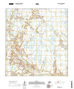
2020 Map of Kwiguk D-6 NE
USGS Topo · Published 2020About this map
Bering Sea tides meet the intricate delta waterways of the Kusilvak Census Area in this modern 2020 topographic record. The landscape is dominated by the complex hydrologic network of the Yukon-Kuskokwim Delta, where the Bugomowik Pass serves as a primary arterial waterway cutting through the marshy lowlands. To the south, the Emmonak Slough branches through the wetlands, illustrating the shifting alluvial patterns of this subarctic coastal region. This survey, based on 2011 SPOT imagery and updated hydrography, provides a high-resolution look at the tidewater interfaces and public land survey boundaries, including t34n r81w and t33n r82w, that define land management in this remote Alaskan environment.
Find a feature on this map
12 named features on this map. Tap any name to fly to it.
Don’t see what you’re looking for? This feature index may not catch every label — zoom into the map to look around manually.
Map Details
Editions of this 2020 Kwiguk D-6 NE Map
This is the sole edition of this map. No revisions or reprints were ever made.
Other maps of this area

1951 · St Michael
USGS Topo · 1:250,000

1952 · Kwiguk
USGS Topo · 1:250,000

1952 · Saint Michael A-5
USGS Topo · 1:63,360
1952 · Saint Michael A-6
USGS Topo · 1:63,360

1952 · Kwiguk D-6
USGS Topo · 1:63,360

1952 · Kwiguk D-5
USGS Topo · 1:63,360

1952 · St Michael
USGS Topo · 1:250,000

1964 · St. Michael
USGS Topo · 1:250,000
2020 · Saint Michael A-5 SW
USGS Topo · 1:25,000
2020 · Saint Michael A-6 SW
USGS Topo · 1:25,000