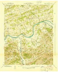
1940 Map of Kykers Ferry
USGS Topo · Published 1940About this map
French Broad River meanders through the heart of the Sevier and Jefferson county borderlands, serving as a primary corridor for transportation and trade before the age of modern bridges. This 1940 field examination by the Tennessee Valley Authority highlights a landscape defined by river crossings such as Kykers Ferry and Hodges Ferry, which connected isolated agricultural communities. To the north, Dumplin Valley and Poor Valley are dotted with small-scale industries like Dumplin Mill and Cook Mill, alongside local landmarks like Hester Knob and Devils Den.
Find a feature on this map
76 named features on this map. Tap any name to fly to it.
Don’t see what you’re looking for? This feature index may not catch every label — zoom into the map to look around manually.
Map Details
Editions of this 1940 Kykers Ferry Map
2 editions found
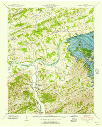
Other maps of this area

1883 · Morristown
USGS Topo · 1:125,000

1886 · Knoxville
USGS Topo · 1:125,000

1892 · Knoxville
USGS Topo · 1:125,000

1893 · Mt Guyot
USGS Topo · 1:125,000

1893 · Morristown
USGS Topo · 1:125,000

1894 · Knoxville
USGS Topo · 1:125,000

1895 · Morristown
USGS Topo · 1:125,000

1895 · Knoxville
USGS Topo · 1:125,000

1897 · Maynardville
USGS Topo · 1:125,000

1900 · Maynardville
USGS Topo · 1:125,000