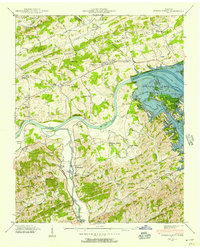
1940 Map of Kykers Ferry
USGS Topo · Published 1957About this map
The French Broad River and Little Pigeon River converge in this 1940 survey of Sevier and Jefferson Counties, shortly before the completion of the Douglas Dam downstream. While the map shows Douglas Lake in its early stages, it preserves the locations of numerous historic river crossings and landmarks that defined this landscape before the full impoundment. Points of interest include Kykers Ferry, Hodges Ferry, and Stokely Ferry, alongside established settlements like Kodak and Catlettsburg.
Find a feature on this map
64 named features on this map. Tap any name to fly to it.
Don’t see what you’re looking for? This feature index may not catch every label — zoom into the map to look around manually.
Map Details
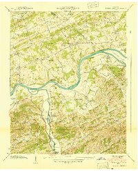
Editions of this 1940 Kykers Ferry Map
2 editions found
Other maps of this area

1883 · Morristown
USGS Topo · 1:125,000

1886 · Knoxville
USGS Topo · 1:125,000

1892 · Knoxville
USGS Topo · 1:125,000

1893 · Mt Guyot
USGS Topo · 1:125,000

1893 · Morristown
USGS Topo · 1:125,000

1894 · Knoxville
USGS Topo · 1:125,000

1895 · Morristown
USGS Topo · 1:125,000

1895 · Knoxville
USGS Topo · 1:125,000

1897 · Maynardville
USGS Topo · 1:125,000

1900 · Maynardville
USGS Topo · 1:125,000