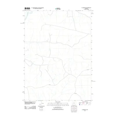
2012 Map of La Barge SE
USGS Topo · Published 2012About this map
The Green River meanders through the northwest corner of this high-desert landscape in Sweetwater County, providing the primary hydrological feature in an otherwise arid expanse of Wyoming. Grounded in a 2012 survey, the map details a network of rural transit and utility routes that define the modern land use of the region. Notable corridors include Co Line Rd, which traces the political boundary, alongside Blm 4203 and Steed Rd. These roads reflect the Bureau of Land Management's influence on the area, serving as vital access points for ranching, energy exploration, and resource management in the sagebrush steppe. The terrain is marked by a complex system of seasonal drainages and draws that feed toward the river basin, illustrating the natural drainage patterns of this corner of the state.
Find a feature on this map
4 named features on this map. Tap any name to fly to it.
Don’t see what you’re looking for? This feature index may not catch every label — zoom into the map to look around manually.
Map Details
Editions of this 2012 La Barge SE Map
This is the sole edition of this map. No revisions or reprints were ever made.
Other maps of this area

1955 · Preston
USGS Topo · 1:250,000

1955 · Lander
USGS Topo · 1:250,000

1958 · Lander
USGS Topo · 1:250,000

1958 · Preston
USGS Topo · 1:250,000

1961 · Lander
USGS Topo · 1:250,000

1962 · Preston
USGS Topo · 1:250,000

1968 · Anderson Canyon
USGS Topo · 1:24,000

1968 · Names Hill
USGS Topo · 1:24,000
1968 · Monument Butte
USGS Topo · 1:24,000

1969 · Oasis Well
USGS Topo · 1:24,000