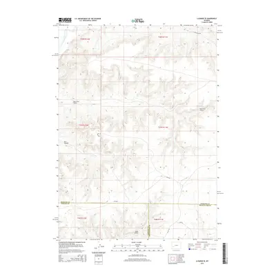
2015 Map of La Barge SE
USGS Topo · Published 2015About this map
The Green River carves through the northwestern corner of this high-desert landscape, marking a stark contrast to the intricate canyon systems that define the surrounding terrain. This region at the meeting of Sublette, Lincoln, and Sweetwater counties is characterized by expansive drainage patterns, including the prominent Figure Four Canyon and Bird Canyon. These natural corridors have long dictated travel and land use, evidenced by the modern road network that follows the topography. Routes such as Chapel Canyon Rd and Bird Canyon Rd provide access through these incisions, while Co Line Rd and Steed Rd traverse the high ground near Steed Canyon. The map reveals the intricate interplay between county jurisdictions and the Bureau of Land Management, which maintains access routes like Blm-4203 across this sparsely populated section of the Wyoming basin.
Find a feature on this map
18 named features on this map. Tap any name to fly to it.
Don’t see what you’re looking for? This feature index may not catch every label — zoom into the map to look around manually.
Map Details
Editions of this 2015 La Barge SE Map
This is the sole edition of this map. No revisions or reprints were ever made.
Other maps of this area

1955 · Preston
USGS Topo · 1:250,000

1955 · Lander
USGS Topo · 1:250,000

1958 · Lander
USGS Topo · 1:250,000

1958 · Preston
USGS Topo · 1:250,000

1961 · Lander
USGS Topo · 1:250,000

1962 · Preston
USGS Topo · 1:250,000

1968 · Anderson Canyon
USGS Topo · 1:24,000

1968 · Names Hill
USGS Topo · 1:24,000
1968 · Monument Butte
USGS Topo · 1:24,000

1969 · Oasis Well
USGS Topo · 1:24,000