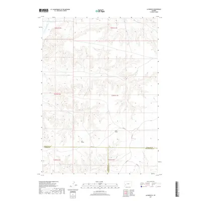
2017 Map of La Barge SE
USGS Topo · Published 2017About this map
The Green River cuts across the far northwestern corner of this high-desert landscape in Sweetwater County, providing a singular water source in a region defined by complex drainage systems and relief. Moving south and east, the terrain is shaped by significant geological features like Bird Canyon and Steed Canyon, which serve as natural landmarks within the expansive basin. This 2017 survey reflects the remote and administrative character of the modern West, where the landscape is segmented by significant jurisdictional boundaries including the convergence of Lincoln, Sublette, and Sweetwater counties.
Find a feature on this map
16 named features on this map. Tap any name to fly to it.
Don’t see what you’re looking for? This feature index may not catch every label — zoom into the map to look around manually.
Map Details
Editions of this 2017 La Barge SE Map
This is the sole edition of this map. No revisions or reprints were ever made.
Other maps of this area

1955 · Preston
USGS Topo · 1:250,000

1955 · Lander
USGS Topo · 1:250,000

1958 · Lander
USGS Topo · 1:250,000

1958 · Preston
USGS Topo · 1:250,000

1961 · Lander
USGS Topo · 1:250,000

1962 · Preston
USGS Topo · 1:250,000

1968 · Anderson Canyon
USGS Topo · 1:24,000

1968 · Names Hill
USGS Topo · 1:24,000
1968 · Monument Butte
USGS Topo · 1:24,000

1969 · Oasis Well
USGS Topo · 1:24,000