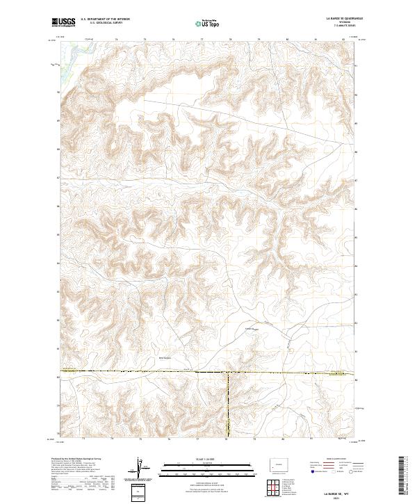
2021 Map of La Barge SE
USGS Topo · Published 2021About this map
The Green River cuts across the northwest corner of this high-desert landscape, marking a significant hydrologic feature in an otherwise arid region of southwest Wyoming. This area serves as a triple junction for three counties, where the boundaries of Sublette, Lincoln, and Sweetwater converge. The terrain is defined by dramatic erosional features like Steed Canyon and Bird Canyon, which demonstrate the drainage patterns typical of the Green River Basin. Transportation is limited to a network of Bureau of Land Management routes, including BLM Rd 4202 and BLM Rd 4203, alongside local connectors like CO Line Rd and Steed Rd. This survey captures the rural, open character of the region as it transitioned into the early 2020s, highlighting the vast public land survey system that organizes this Wyoming backcountry.
Find a feature on this map
16 named features on this map. Tap any name to fly to it.
Don’t see what you’re looking for? This feature index may not catch every label — zoom into the map to look around manually.
Map Details
Editions of this 2021 La Barge SE Map
This is the sole edition of this map. No revisions or reprints were ever made.
Other maps of this area

1955 · Preston
USGS Topo · 1:250,000

1955 · Lander
USGS Topo · 1:250,000

1958 · Lander
USGS Topo · 1:250,000

1958 · Preston
USGS Topo · 1:250,000

1961 · Lander
USGS Topo · 1:250,000

1962 · Preston
USGS Topo · 1:250,000

1968 · Anderson Canyon
USGS Topo · 1:24,000

1968 · Names Hill
USGS Topo · 1:24,000
1968 · Monument Butte
USGS Topo · 1:24,000

1969 · Oasis Well
USGS Topo · 1:24,000