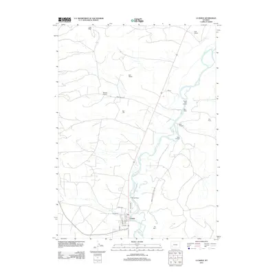
2012 Map of La Barge
USGS Topo · Published 2012About this map
La Barge sits at the intersection of high-desert energy production and the winding course of the Green River, anchored by a grid of streets including 1st Ave, Cedar St, and 6th Ave. The landscape is defined by its industrial and topographic character, with the Beneficial Oil Rd and Bureau Of Land Mgmt Road 4203 cutting through a terrain of distinctively named formations like Bird Nipple, Red Hill, and The Frog. The river's path is marked by crossings such as the Whelan Bridge and numerous drainage features including Birch Cr, Bird Draw, and Bess Canyon. This area illustrates the late 20th and early 21st-century Wyoming pattern of a small residential hub supporting extensive public land access and mineral extraction across the surrounding breaks and mesas.
Find a feature on this map
27 named features on this map. Tap any name to fly to it.
Don’t see what you’re looking for? This feature index may not catch every label — zoom into the map to look around manually.
Map Details
Editions of this 2012 La Barge Map
This is the sole edition of this map. No revisions or reprints were ever made.
Other maps of this area

1945 · Fort Hill
USGS Topo · 1:62,500

1947 · Fort Hill
USGS Topo · 1:62,500

1955 · Preston
USGS Topo · 1:250,000

1958 · Preston
USGS Topo · 1:250,000

1962 · Preston
USGS Topo · 1:250,000

1968 · Anderson Canyon
USGS Topo · 1:24,000

1968 · Names Hill
USGS Topo · 1:24,000

1969 · Chimney Butte
USGS Topo · 1:24,000

1969 · La Barge
USGS Topo · 1:24,000
1969 · Milleson Draw
USGS Topo · 1:24,000