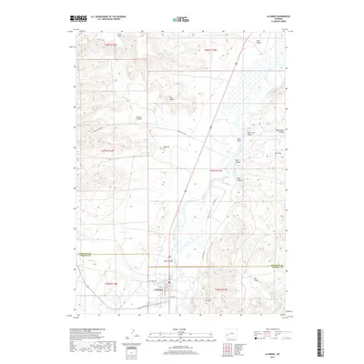
2017 Map of La Barge
USGS Topo · Published 2017About this map
La Barge sits at the southern edge of this western Wyoming landscape, situated where the high desert terrain meets the fertile bottomlands of the Green River. The town's grid, including S Main St and W 6th Ave, marks a concentrated pocket of settlement surrounded by vast mesas and winding canyons. The river corridor is a focal point of the area, crossed by the Whelan Bridge and fed by Birch Cr near the Sublette and Lincoln County line.
Find a feature on this map
29 named features on this map. Tap any name to fly to it.
Don’t see what you’re looking for? This feature index may not catch every label — zoom into the map to look around manually.
Map Details
Editions of this 2017 La Barge Map
This is the sole edition of this map. No revisions or reprints were ever made.
Other maps of this area

1945 · Fort Hill
USGS Topo · 1:62,500

1947 · Fort Hill
USGS Topo · 1:62,500

1955 · Preston
USGS Topo · 1:250,000

1958 · Preston
USGS Topo · 1:250,000

1962 · Preston
USGS Topo · 1:250,000

1968 · Anderson Canyon
USGS Topo · 1:24,000

1968 · Names Hill
USGS Topo · 1:24,000

1969 · Chimney Butte
USGS Topo · 1:24,000

1969 · La Barge
USGS Topo · 1:24,000
1969 · Milleson Draw
USGS Topo · 1:24,000