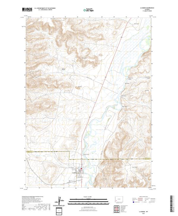
2021 Map of La Barge
USGS Topo · Published 2021About this map
La Barge sits at the southern edge of this West Wyoming landscape, where the high desert meets the irrigated river valley. The Green River dominates the eastern half of the map, supporting an intricate system of water management including the Green River Island Ditch and the Cowdell Waste Water Ditch. This era of the region is defined by a mix of traditional ranching geography and industrial infrastructure, evidenced by the presence of Beneficial Oil Rd cutting across the terrain. To the north and west, the landscape rises into a series of deeply etched drainages and uniquely named landmarks such as Bird Nipple, The Frog, and Wildcat Canyon. The map records the local transportation network crossing the water at Whelan Bridge, while the boundary between Sublette and Lincoln Counties bisects the northern reach of the town site.
Find a feature on this map
32 named features on this map. Tap any name to fly to it.
Don’t see what you’re looking for? This feature index may not catch every label — zoom into the map to look around manually.
Map Details
Editions of this 2021 La Barge Map
This is the sole edition of this map. No revisions or reprints were ever made.
Other maps of this area

1945 · Fort Hill
USGS Topo · 1:62,500

1947 · Fort Hill
USGS Topo · 1:62,500

1955 · Preston
USGS Topo · 1:250,000

1958 · Preston
USGS Topo · 1:250,000

1962 · Preston
USGS Topo · 1:250,000

1968 · Anderson Canyon
USGS Topo · 1:24,000

1968 · Names Hill
USGS Topo · 1:24,000

1969 · Chimney Butte
USGS Topo · 1:24,000

1969 · La Barge
USGS Topo · 1:24,000
1969 · Milleson Draw
USGS Topo · 1:24,000