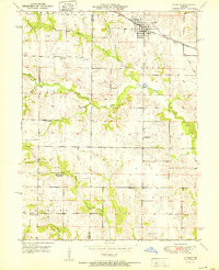
1951 Map of La Belle
USGS Topo · Published 1951About this map
La Belle serves as the primary hub of this northern Missouri landscape, situated along the Chicago Burlington and Quincy railroad line. The surrounding rural landscape is defined by an intricate network of waterways, including Troublesome Creek, Grassy Creek, and Million Creek, which carve through the townships of Salem, Fabius, and La Belle. This mid-century survey reveals a traditional settlement pattern characterized by numerous country schools spaced for walking distances, such as Jeddo Sch, Sweet Oak Sch, and Salem Sch.
Find a feature on this map
21 named features on this map. Tap any name to fly to it.
Don’t see what you’re looking for? This feature index may not catch every label — zoom into the map to look around manually.
Map Details
Editions of this 1951 La Belle Map
2 editions found
Other maps of this area

1903 · Kahoka
USGS Topo · 1:125,000

1903 · Palmyra
USGS Topo · 1:125,000

1903 · Edina
USGS Topo · 1:125,000

1948 · Quincy
USGS Topo · 1:250,000

1950 · Williamstown
USGS Topo · 1:24,000

1950 · Lewistown
USGS Topo · 1:24,000

1950 · La Belle
USGS Topo · 1:24,000

1951 · La Belle
USGS Topo · 1:24,000
1951 · Lewistown
USGS Topo · 1:24,000
1951 · Williamstown
USGS Topo · 1:24,000