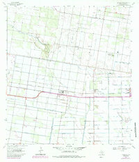
1963 Map of La Blanca
USGS Topo · Published 1984About this map
The irrigated landscape of Hidalgo County is defined by an intricate network of water management and energy extraction just north of the border in the early 1960s. San Carlos and La Blanca serve as central nodes for the surrounding agricultural tracts, linked by the Southern Pacific railroad line that cuts horizontally across the territory. This rail corridor supported industrial hubs like Elsa, where a refinery, substation, and filtration plant indicate a developed infrastructure for processing and distribution.
Find a feature on this map
20 named features on this map. Tap any name to fly to it.
Don’t see what you’re looking for? This feature index may not catch every label — zoom into the map to look around manually.
Map Details
Editions of this 1963 La Blanca Map
2 editions found
Other maps of this area

1914 · San Juan
USGS Topo · 1:48,000

1916 · San Juan
USGS Topo · 1:62,500

1949 · Mc Allen
USGS Topo · 1:250,000

1953 · Brownsville
USGS Topo · 1:250,000

1954 · McAllen
USGS Topo · 1:250,000

1956 · Mercedes
USGS Topo · 1:24,000

1956 · Brownsville
USGS Topo · 1:250,000

1956 · Port Isabel
USGS Topo · 1:250,000
1957 · Lasara
USGS Topo · 1:24,000
1957 · Edcouch
USGS Topo · 1:24,000