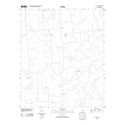
2010 Map of La Casa
USGS Topo · Published 2010About this map
Mount Zion Cemetery serves as a primary genealogical landmark in this cattle and ranching region of Stephens County. The landscape is defined by the convergence of several significant watercourses, including the westward flow of Caddo Creek and the southern reaches of Palo Pinto Creek. Small rural clusters like La Casa and Bullock are connected by a network of farm-to-market roads, specifically FM 207 and FM 717, which facilitate movement across the open plains and wooded creek bottoms.
Find a feature on this map
32 named features on this map. Tap any name to fly to it.
Don’t see what you’re looking for? This feature index may not catch every label — zoom into the map to look around manually.
Map Details
Editions of this 2010 La Casa Map
This is the sole edition of this map. No revisions or reprints were ever made.
Other maps of this area

1890 · Breckenridge
USGS Topo · 1:125,000

1894 · Eastland
USGS Topo · 1:125,000

1954 · Abilene
USGS Topo · 1:250,000

1958 · Abilene
USGS Topo · 1:250,000
1966 · Bear Mountain
USGS Topo · 1:24,000

1966 · Eastland
USGS Topo · 1:24,000

1966 · Ranger
USGS Topo · 1:24,000
1967 · Wayland
USGS Topo · 1:24,000

1967 · Necessity
USGS Topo · 1:24,000
1967 · Caddo NE
USGS Topo · 1:24,000