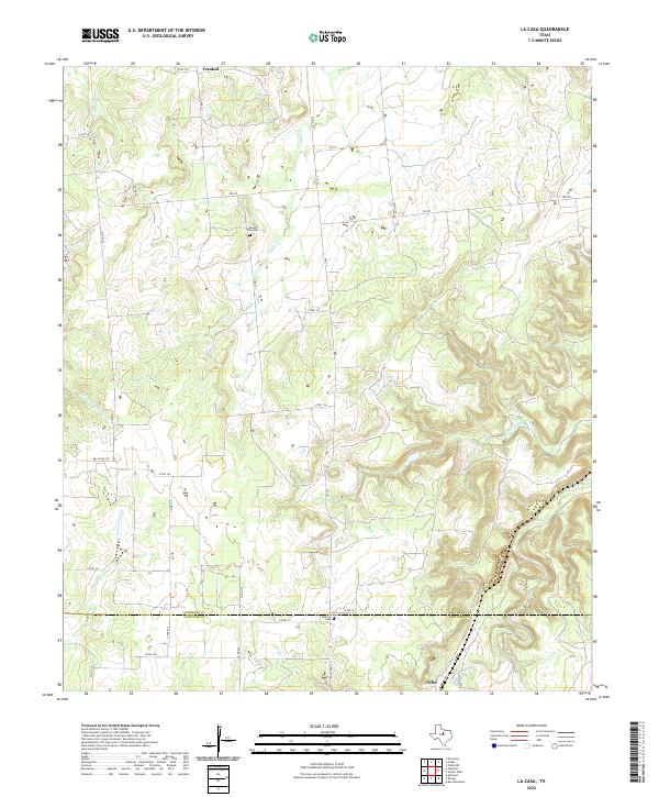
2022 Map of La Casa
USGS Topo · Published 2022About this map
Frankell sits in the northern reaches of this landscape, where the terrain is defined by the headwaters of numerous branching streams. The area is marked by a network of county roads and farm-to-market routes like FM 207 and FM 717, which connect scattered homesteads and local landmarks across the Stephens Co and Eastland Co border. For genealogists and local historians, the presence of Mount Zion Cem and Bullock Cem provides specific points of interest for family research. The drainage pattern is particularly intricate, featuring named waterways such as Caddo Cr, Cottonwood Cr, and Palo Pinto Cr. In the southern portion of the map, the small settlement of Tiffin lies near the intersection of several local roads, serving as a focal point for the rural community in the early 21st century.
Find a feature on this map
38 named features on this map. Tap any name to fly to it.
Don’t see what you’re looking for? This feature index may not catch every label — zoom into the map to look around manually.
Map Details
Editions of this 2022 La Casa Map
This is the sole edition of this map. No revisions or reprints were ever made.
Other maps of this area

1890 · Breckenridge
USGS Topo · 1:125,000

1894 · Eastland
USGS Topo · 1:125,000

1954 · Abilene
USGS Topo · 1:250,000

1958 · Abilene
USGS Topo · 1:250,000
1966 · Bear Mountain
USGS Topo · 1:24,000

1966 · Eastland
USGS Topo · 1:24,000

1966 · Ranger
USGS Topo · 1:24,000
1967 · Wayland
USGS Topo · 1:24,000

1967 · Necessity
USGS Topo · 1:24,000
1967 · Caddo NE
USGS Topo · 1:24,000