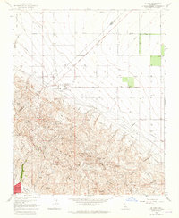
1963 Map of La Cima
USGS Topo · Published 1965About this map
The Kettleman North Dome Oil and Gas Field dominates this 1963 landscape, revealing an intensive industrial infrastructure of pipelines, sumps, and substations concentrated along the ridges. The terrain is defined by the corrugated spurs of the Kettleman Hills, where dozens of Spanish-named features like El Serrijon, La Cuesta, and El Tolete line the complex topography. To the north and west, the dramatic shift to the flat Kettleman Plain is marked by a rigid grid of agricultural avenues, including Firestone Ave and Plymouth Ave.
Find a feature on this map
68 named features on this map. Tap any name to fly to it.
Don’t see what you’re looking for? This feature index may not catch every label — zoom into the map to look around manually.
Map Details
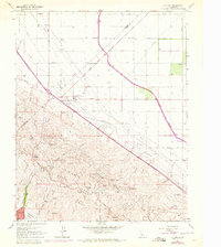
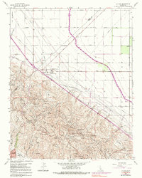
Editions of this 1963 La Cima Map
3 editions found
Other maps of this area

1912 · Coalinga
USGS Topo · 1:125,000

1914 · Lost Hills
USGS Topo · 1:125,000

1914 · Cholame
USGS Topo · 1:125,000

1915 · Cholame
USGS Topo · 1:125,000

1917 · Cholame
USGS Topo · 1:125,000

1929 · Westhaven
USGS Topo · 1:31,680

1930 · Discovery Well
USGS Topo · 1:31,680

1930 · Canoas Creek
USGS Topo · 1:31,680

1930 · Kettleman Plain
USGS Topo · 1:31,680

1930 · Middle Dome
USGS Topo · 1:31,680