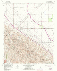
1963 Map of La Cima
USGS Topo · Published 1991About this map
The Kettleman North Dome Hills dominate this mid-century landscape, defined by a dense network of energy infrastructure and water management. Numerous named summits like Cerro Lodoso and Hydril Hill overlook a sprawling Oil and Gas Field, where pipelines and access roads carve through the ridges. This industrial character is punctuated by technical facilities including the Kettleman Compressor Sta and a Booster Station along the ridges.
Find a feature on this map
76 named features on this map. Tap any name to fly to it.
Don’t see what you’re looking for? This feature index may not catch every label — zoom into the map to look around manually.
Map Details
Editions of this 1963 La Cima Map
3 editions found
Other maps of this area

1912 · Coalinga
USGS Topo · 1:125,000

1914 · Lost Hills
USGS Topo · 1:125,000

1914 · Cholame
USGS Topo · 1:125,000

1915 · Cholame
USGS Topo · 1:125,000

1917 · Cholame
USGS Topo · 1:125,000

1929 · Westhaven
USGS Topo · 1:31,680

1930 · Discovery Well
USGS Topo · 1:31,680

1930 · Canoas Creek
USGS Topo · 1:31,680

1930 · Kettleman Plain
USGS Topo · 1:31,680

1930 · Middle Dome
USGS Topo · 1:31,680