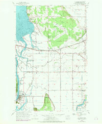
1956 Map of La Conner
USGS Topo · Published 1969About this map
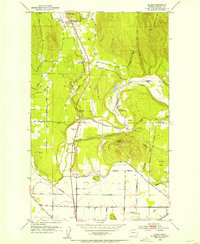
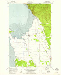
La Conner and the surrounding delta of the Skagit River reveal a landscape defined by intricate waterways and productive lowlands in the mid-1950s. The town of La Conner is situated along the Swinomish Channel, a vital maritime link between Skagit Bay and Padilla Bay. To the east, the map shows the transition from the marshy flats of Olympia Marsh and Indian Slough to the elevated terrain of View Ridge. This era shows a community in flux, with small settlements like Fredonia and Whitney appearing along the Great Northern rail lines and the Memorial Highway. Several community landmarks, such as the Pleasant Ridge Sch and Harmony Sch, are noted as abandoned, indicating a shift in rural education and settlement patterns. The presence of the Mount Vernon Airport and Bay View State Park highlights the area's development for transportation and recreation.
Find a feature on this map
53 named features on this map. Tap any name to fly to it.
Don’t see what you’re looking for? This feature index may not catch every label — zoom into the map to look around manually.
Map Details
Editions of this 1956 La Conner Map
4 editions found
Other maps of this area

1911 · Mount Vernon
USGS Topo · 1:125,000

1918 · Samish Lake
USGS Topo · 1:62,500

1940 · Mt Vernon
USGS Topo · 1:62,500

1943 · Mt Vernon
USGS Topo · 1:62,500

1943 · Deception Pass
USGS Topo · 1:62,500

1943 · Anacortes
USGS Topo · 1:62,500

1951 · Deception Pass
USGS Topo · 1:62,500

1951 · Anacortes
USGS Topo · 1:62,500
1952 · Alger
USGS Topo · 1:24,000
1954 · Bow
USGS Topo · 1:24,000