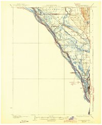
1930 Map of La Crescent
USGS Topo · Published 1944About this map
La Crosse and its immediate riverine surroundings are defined by an intricate network of waterways and islands along the Mississippi River in the late 1920s. The map captures a complex environment where industrial and agricultural life met the shifting sloughs and chutes of the Upper Mississippi, including Hammond Chute and Broken Gun Slough. This survey is notable for its early use of aerial photography compiled by the Army Air Corps to document the shifting drainage patterns of French Island and its smaller neighbors. Rural education centers like Oak Grove Sch and Lower Brice Prairie Sch serve as markers for the era's farming communities, while the Chicago and Northwestern and Chicago Burlington and Quincy railroads illustrate the corridor's critical role in Midwestern transit and transport.
Find a feature on this map
49 named features on this map. Tap any name to fly to it.
Don’t see what you’re looking for? This feature index may not catch every label — zoom into the map to look around manually.
Map Details
Editions of this 1930 La Crescent Map
3 editions found
Other maps of this area

1926 · Stoddard
USGS Topo · 1:62,500

1926 · North Bend
USGS Topo · 1:62,500

1927 · La Crosse
USGS Topo · 1:62,500

1929 · Fountain City
USGS Topo · 1:62,500

1929 · Galesville
USGS Topo · 1:62,500

1929 · North Bend
USGS Topo · 1:62,500

1930 · La Crescent
USGS Topo · 1:62,500

1930 · La Crosse
USGS Topo · 1:62,500

1934 · Winona
USGS Topo · 1:62,500

1937 · Winona
USGS Topo · 1:62,500