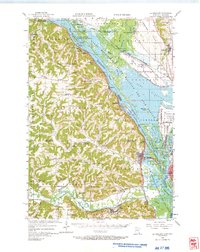
1956 Map of La Crescent
USGS Topo · Published 1966About this map
The Mississippi River creates a complex network of chutes and sloughs including Gibbs Chute and Dresbach Slough as it winds through the Upper Mississippi River Wildlife and Fish Refuge. This mid-century landscape is defined by the proximity of industrial transit and rural education, where the Chicago Milwaukee St Paul and Pacific rail line runs parallel to the water through settlements like Dakota and Dresbach.
Find a feature on this map
133 named features on this map. Tap any name to fly to it.
Don’t see what you’re looking for? This feature index may not catch every label — zoom into the map to look around manually.
Map Details
Editions of this 1956 La Crescent Map
2 editions found

Other maps of this area

1926 · Stoddard
USGS Topo · 1:62,500

1926 · North Bend
USGS Topo · 1:62,500

1927 · La Crosse
USGS Topo · 1:62,500

1929 · Fountain City
USGS Topo · 1:62,500

1929 · Galesville
USGS Topo · 1:62,500

1929 · North Bend
USGS Topo · 1:62,500

1930 · La Crescent
USGS Topo · 1:62,500

1930 · La Crosse
USGS Topo · 1:62,500

1934 · Winona
USGS Topo · 1:62,500

1937 · Winona
USGS Topo · 1:62,500