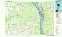
1984 Map of La Crosse
USGS Topo · Published 1985About this map
The Mississippi River valley serves as the central artery for this tri-state region, where the Upper Mississippi River Wild Life and Fish Refuge dominates the riparian corridor. On the Wisconsin side, La Crosse and Onalaska stand as the primary urban centers, with French Island and Lake Onalaska highlighting the complex water system. Across the river in Minnesota, the topography shifts into the deeply dissected ridges of the Richard J Dorer Memorial Hardwood State Forest, a landscape marked by dozens of named geographic features like Vinegar Hill and Oak Ridge.
Find a feature on this map
189 named features on this map. Tap any name to fly to it.
Don’t see what you’re looking for? This feature index may not catch every label — zoom into the map to look around manually.
Map Details
Editions of this 1984 La Crosse Map
This is the sole edition of this map. No revisions or reprints were ever made.
Other maps of this area

1903 · Waukon
USGS Topo · 1:125,000

1906 · Decorah
USGS Topo · 1:125,000

1909 · Sparta
USGS Topo · 1:62,500

1923 · Viroqua
USGS Topo · 1:62,500

1924 · Gays Mills
USGS Topo · 1:62,500

1926 · Gays Mills
USGS Topo · 1:62,500

1926 · Stoddard
USGS Topo · 1:62,500

1926 · Viroqua
USGS Topo · 1:62,500

1926 · North Bend
USGS Topo · 1:62,500

1927 · La Crosse
USGS Topo · 1:62,500