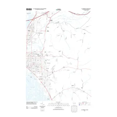
2013 Map of La Crosse
USGS Topo · Published 2013About this map
Prairie La Crosse and North La Crosse anchor this 2013 survey of the Mississippi River riverfront, where the city's grid meets a complex system of waterways. The landscape is defined by the sharp contrast between the urban development of Grand Crossing and the prominent ridges that rise to the east. Landmarks such as the Goosetown Monument and Veterans Memorial Stadium provide specific points of local interest within the city, while Green Island sits between the Mississippi River and Swift Creek. The eastern portion of the map is dominated by the unique geography of coulees, including State Road Coulee and Smith Valley, which channel roads and settlements like Shelby between high bluffs. These formations, such as Granddad Bluff and Cliffwood Bluff, create a dramatic natural boundary to the expansion of Herrington and the surrounding residential areas.
Find a feature on this map
117 named features on this map. Tap any name to fly to it.
Don’t see what you’re looking for? This feature index may not catch every label — zoom into the map to look around manually.
Map Details
Editions of this 2013 La Crosse Map
This is the sole edition of this map. No revisions or reprints were ever made.
Other maps of this area

1926 · Stoddard
USGS Topo · 1:62,500

1927 · La Crosse
USGS Topo · 1:62,500

1930 · La Crescent
USGS Topo · 1:62,500

1930 · La Crosse
USGS Topo · 1:62,500

1956 · Brownsville
USGS Topo · 1:62,500

1956 · La Crescent
USGS Topo · 1:62,500

1958 · La Crosse
USGS Topo · 1:250,000

1961 · La Crosse
USGS Topo · 1:250,000
1963 · Onalaska
USGS Topo · 1:24,000
1963 · St. Joseph
USGS Topo · 1:24,000