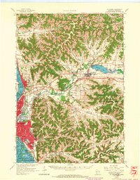
1963 Map of La Crosse
USGS Topo · Published 1965About this map
The Mississippi River and its labyrinthine backwaters define the western edge of this 1963 survey, where the cities of La Crosse and Onalaska meet the dramatic bluffs of the Driftless Area. This landscape is characterized by a dense network of coulees — steep-walled valleys like Bostwick Valley and Long Coulee — that carve through the high ridges. These narrow corridors provide the primary routes for both roads and railroads, including the Chicago Milwaukee St Paul and Pacific line. Significant institutions of the era are well-documented, from Wisconsin State College and Holy Cross Seminary to the County Hospital and County Infirmary. Beyond the urban centers, small rural nodes like Barre Mills and West Salem serve as local anchors, while prominent landforms like Granddad Bluff and Miller Bluff tower over the river valley.
Find a feature on this map
130 named features on this map. Tap any name to fly to it.
Don’t see what you’re looking for? This feature index may not catch every label — zoom into the map to look around manually.
Map Details
Editions of this 1963 La Crosse Map
3 editions found
Other maps of this area

1909 · Sparta
USGS Topo · 1:62,500

1923 · Viroqua
USGS Topo · 1:62,500

1926 · Stoddard
USGS Topo · 1:62,500

1926 · Viroqua
USGS Topo · 1:62,500

1926 · North Bend
USGS Topo · 1:62,500

1927 · La Crosse
USGS Topo · 1:62,500

1928 · Melrose
USGS Topo · 1:48,000

1929 · Galesville
USGS Topo · 1:62,500

1929 · North Bend
USGS Topo · 1:62,500

1930 · La Crescent
USGS Topo · 1:62,500