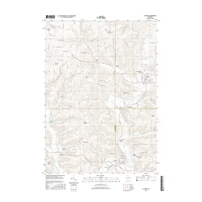
2016 Map of La Farge
USGS Topo · Published 2016About this map
The Kickapoo River meanders through this portion of the Driftless Area, anchoring several valley communities such as La Farge and Viola. The landscape is defined by its series of ridges and deep hollows, where local history is recorded in numerous rural burial grounds like Mount Zion Cem and Star Cem. The village of La Farge serves as a central hub, while smaller crossroads and hamlets like Tunnelville and Liberty trace the earlier settlement patterns of Vernon and Richland counties. Topographic landmarks such as Mt Nebo, Sheldon Mt, and the distinctive Fort Wales Rock overlook the winding river valley. To the west, the W Fork Kickapoo River cuts through Pleasant Ridge, while numerous tributary streams like Otter Cr and Elk Run have carved out the secondary valleys that supported the region's agricultural homesteads.
Find a feature on this map
105 named features on this map. Tap any name to fly to it.
Don’t see what you’re looking for? This feature index may not catch every label — zoom into the map to look around manually.
Map Details
Editions of this 2016 La Farge Map
This is the sole edition of this map. No revisions or reprints were ever made.
Other maps of this area

1923 · Viroqua
USGS Topo · 1:62,500

1924 · Gays Mills
USGS Topo · 1:62,500

1926 · Gays Mills
USGS Topo · 1:62,500

1926 · Viroqua
USGS Topo · 1:62,500

1926 · La Farge
USGS Topo · 1:62,500

1933 · Boaz
USGS Topo · 1:62,500

1958 · La Crosse
USGS Topo · 1:250,000

1961 · La Crosse
USGS Topo · 1:250,000

1965 · La Crosse
USGS Topo · 1:250,000

1965 · La Farge
USGS Topo · 1:62,500