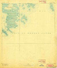
1893 Map of La Fortuna
USGS Topo · Published 1902About this map
Isle Au Breton Sound dominates this late-nineteenth-century coastal survey of the St. Bernard Parish wetlands, illustrating a precarious and shifting landscape before the coastal erosion of the modern era. Compiled by H.L. Baldwin Jr. of the U.S. Public Land Office, the map details a labyrinth of brackish waterways and marshy points that defined the maritime economy of southeast Louisiana. Navigation routes are etched through narrow openings like Pass Fernandea and the winding Bayou Frenne Picant, which connect larger water bodies such as Lake Athanasio and Lake La Fortuna. This cartography documents the specific coastal geometry of the 1890s, including landforms like Pt. Chicot and Pt. La Fortuna that served as vital landmarks for local fishermen and coastal traders navigating between Eloi Bay and the Gulf of Mexico.
Find a feature on this map
10 named features on this map. Tap any name to fly to it.
Don’t see what you’re looking for? This feature index may not catch every label — zoom into the map to look around manually.
Map Details
Editions of this 1893 La Fortuna Map
3 editions found
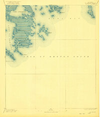
Other maps of this area

1892 · Quarantine
USGS Topo · 1:62,500

1893 · La Fortuna
USGS Topo · 1:62,500

1893 · Forts
USGS Topo · 1:62,500

1893 · Chandeleur
USGS Topo · 1:62,500

1893 · Shell Beach
USGS Topo · 1:62,500

1893 · Dime
USGS Topo · 1:62,500

1895 · Bodreau
USGS Topo · 1:62,500

1935 · Taylor Pass
USGS Topo · 1:31,680

1935 · Morgan Harbor
USGS Topo · 1:31,680

1935 · Lake Athanasio
USGS Topo · 1:31,680