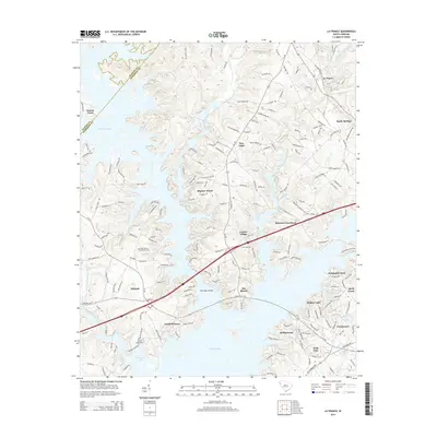
2014 Map of La France
USGS Topo · Published 2014About this map
Hartwell Lake dominates the western and southern reaches of this landscape, its dendritic fingers reaching deep into the Piedmont terrain where Anderson Co meets Pickens Co and Oconee Co. The map reveals a complex interface between large-scale water management and established rural communities. Historic focal points such as Cedar Grove Methodist Cem and Smiths Chapel Cem remain preserved alongside modern residential developments like Bridgewater and Fairfield Acres. The northeastern corner is anchored by La France and Sandy Springs, connected to the southern reaches by a network of state routes including SC-187 and SC-24. These roads traverse a landscape drained by the historic flow of Eighteenmile Cr and Three and Twenty Creek, illustrating how modern infrastructure and 21st-century subdivisions have integrated with the area's traditional agricultural and creek-bottom roots.
Find a feature on this map
35 named features on this map. Tap any name to fly to it.
Don’t see what you’re looking for? This feature index may not catch every label — zoom into the map to look around manually.
Map Details
Editions of this 2014 La France Map
This is the sole edition of this map. No revisions or reprints were ever made.
Other maps of this area

1888 · Pickens
USGS Topo · 1:125,000

1893 · Elberton
USGS Topo · 1:125,000

1894 · Pickens
USGS Topo · 1:125,000

1950 · La France
USGS Topo · 1:24,000

1951 · La France
USGS Topo · 1:24,000

1951 · Clemson
USGS Topo · 1:24,000

1954 · Greenville
USGS Topo · 1:250,000

1957 · Anderson
USGS Topo · 1:62,500

1958 · Greenville
USGS Topo · 1:250,000

1958 · Seneca
USGS Topo · 1:24,000