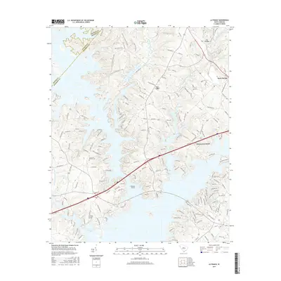
2017 Map of La France
USGS Topo · Published 2017About this map
Hartwell Lake dominates the southern landscape of this South Carolina region, where the borders of Anderson, Oconee, and Pickens counties converge. The jagged shoreline of the reservoir creates numerous peninsulas and inlets, influencing the local road network that connects small settlements like La France and New Light. This modern topographical survey shows a landscape where historical burial grounds, such as Cedar Grove Methodist Cem and Smiths Chapel Cem, remain preserved amidst newer recreational infrastructure. Inland, the terrain is defined by significant watercourses including Eighteenmile Creek and Three and Twenty Creek, while the northwestern corner features an extensive trail system including the Red Square Trail and Fant's Grove Perimeter Loop, suggesting a transition from agricultural roots to modern land management and conservation.
Find a feature on this map
166 named features on this map. Tap any name to fly to it.
Don’t see what you’re looking for? This feature index may not catch every label — zoom into the map to look around manually.
Map Details
Editions of this 2017 La France Map
This is the sole edition of this map. No revisions or reprints were ever made.
Other maps of this area

1888 · Pickens
USGS Topo · 1:125,000

1893 · Elberton
USGS Topo · 1:125,000

1894 · Pickens
USGS Topo · 1:125,000

1950 · La France
USGS Topo · 1:24,000

1951 · La France
USGS Topo · 1:24,000

1951 · Clemson
USGS Topo · 1:24,000

1954 · Greenville
USGS Topo · 1:250,000

1957 · Anderson
USGS Topo · 1:62,500

1958 · Greenville
USGS Topo · 1:250,000

1958 · Seneca
USGS Topo · 1:24,000